Bayside Area Development Plan
The Bayside Area Development Plan is complete and the City Council adopted the Plan on December 10, 2024.
The Final Draft of the Bayside Area Development Plan was adopted on December 10, 2024 and is now available. Please see the flipbook below, or view PDF versions by clicking on the links on the right, or below if using a mobile device.
About the Plan
The current plan, adopted in 1995, no longer reflects the current conditions of the area. A new planning process will get updated feedback from the public on existing conditions and the community’s priorities and goals. Once this is complete, the community will identify action steps to achieve goals. Action steps could be an improvement project to city infrastructure or changes to City policy.
Community involvement will be a key part of the process. Over the next year, there will be multiple ways to participate such as surveys and public meetings. Click here to receive email updates about the Bayside Area Development Plan.


Welcome to the Bayside Area Development Project Site!
![]()
Sign Up for Project Email Updates!

Meet the Project Manager
-
Senior City Planner

Phone 361-826-3246 Email AmandaT@cctexas.com
Videos


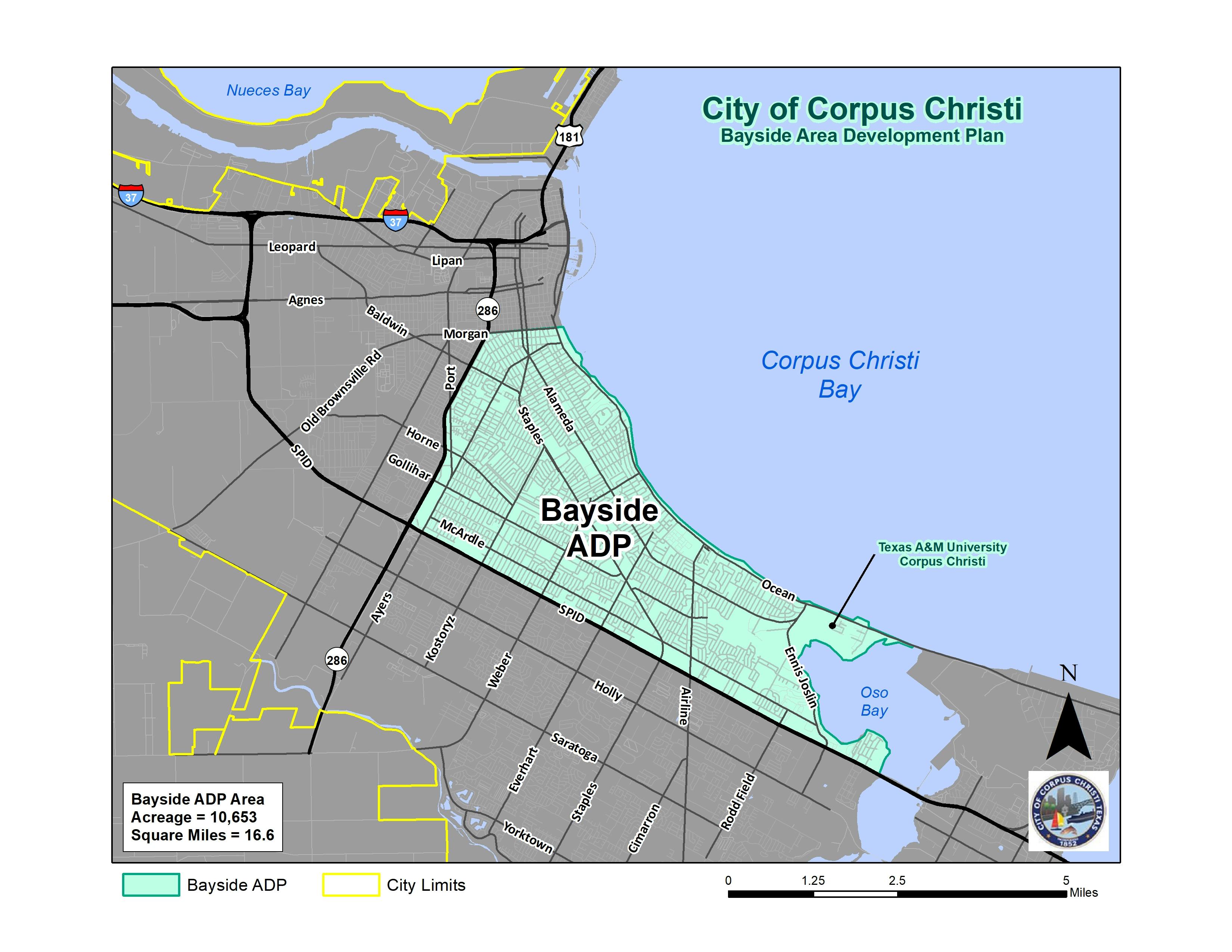
Study Area Map
Project Documents
-
 Stakeholder Advisory Committee Roster (130 KB) (pdf)
-
 Public Hearing Documents
-
Round 1 Engagement
-
Round 2 Engagement
-
Advisory Committee Meeting #2 Presentation - November 2022 (24 MB) (pdf)
-
Community Discussions Summary Report - January 2023 (6.57 MB) (pdf)
-
Community Meeting #1 Presentation - February 2023 (2.36 MB) (pdf)
-
Open House Exhibit Boards - Feb. 23, 2023
-
Bayside Open House #1 Summary - Feb. 23, 2023 (6.73 MB) (pdf)
-
-
Round 3 Engagement
